


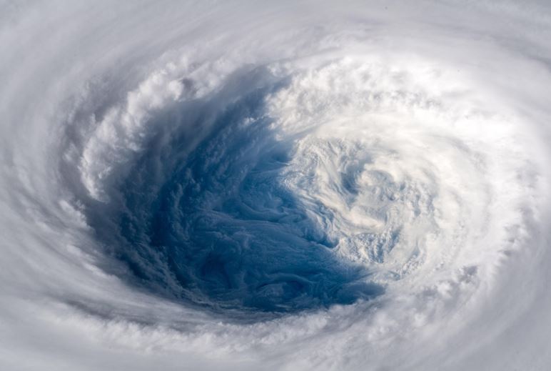
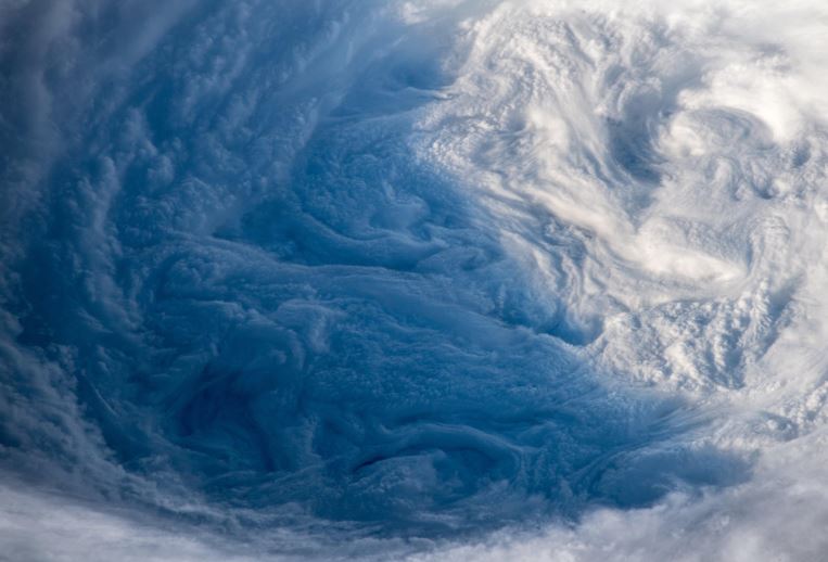
An astronaut from the European Space Agency shared remarkable shots of Super Typhoon Paeng (International name Trami) on Twitter as it headed toward Japan and Taiwan.
German astronaut Alexander Gerst described the typhoon rendered in the images as pulling “the planet’s gigantic plug.”
“As if somebody pulled the planet’s gigantic plug. Staring down the eye of yet another fierce storm. Category 5 Super Typhoon Trami is unstoppable and heading for Japan and Taiwan. Be safe down there!” Gerst said.

Gerst, a geophysicist and a volcanologist, also became popular for his images of Hurricane Florence, another big storm that tore through the United States.
In 2014, he became part of a space mission of the International Space Station-ESA called Blue Dot mission. Gerst is now in his second space mission called Horizons as part of the 57th expedition to the ISS.
Typhoon Paeng was initially forecasted to be not as fierce as Typhoon Ompong (Mangkhut), which is considered as the strongest storm to hit the country in 2018.
The eye of the Paeng packed winds of 125 kilometers per hour and moves at a pace of 20 kph while Ompong entered the country with maximum winds of up to 205 kph with a speed of 30 kph.
Super Typhoon Trami’s slow pace?
Recent reports show Paeng getting stronger as it moves out of the Philippine area of responsibility and gaining winds of 200 kph and gustiness of up to 240 kph over the Philippine Sea.
The United States Joint Typhoon Warning Center has classified it a Super Typhoon, a term given to the strongest of typhoons with winds that reach at least 240 kph.
However, new forecasts report Trami’s intensity is fluctuating in-between the Category 4 and 5 of the Saffir-Simpson scale and also quite slow at only 1.85 kph.
The “sluggish” winds over the seas play a big role in this phenomenon, a report from Washington Post said.
“The winds aloft in the atmosphere are weak. That means there’s nothing to push and pull a storm. While these sluggish winds are conducive to cyclone growth without the threat of being torn apart, they also pose a challenge,” Matthew Cappucci wrote.


